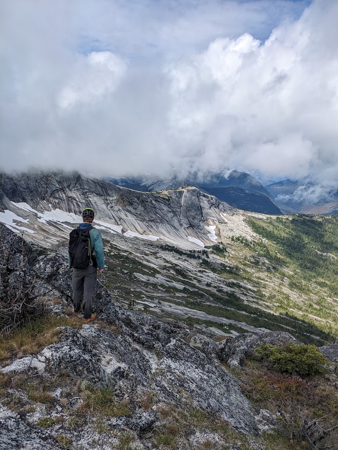
With a few days to spare between guiding trips on the West Coast Trail and in Wells Gray Park, I finally had a chance to tick off a pair of peaks in the Coquihalla that I had been looking at for years.
The original plan had been easy alpine climbing around Mount Rexford and the Nesakwatch Spires. A friend was on his way out from the Rockies, sleeping in his truck, and given the long approach we had agreed on an alpine start. Unfortunately, and somewhat embarrassingly, I had left my phone on silent and overslept by four hours, which shot that plan in the foot. Vicuna and Guanaco became the pivot: a way to still get a couple of peaks in with some light scrambling.
It had rained the night before we left, so the bush was soaked, pushing through the wet alder on the overgrown road got us wet in no time. The rock up high was slightly damp, but not too bad on the crux thankfully. We had taken burly boots for the water resistance, which was the right call for the road and the marshy ground at treeline, but somewhat cumbersome for the scramble. On a hot, dry summer day, lighter footwear would be nice.
Segments
| Section | Dist. | Gain | Loss | Time |
|---|---|---|---|---|
| Parking to end of road | 4.5 km | +90 m | -30 m | 0:51 |
| Climbers trail and subalpine to Vicuna summit | 3.1 km | +865 m | 0 m | 2:01 |
| Vicuna to Guanaco, via the saddle | 1.4 km | +160 m | -160 m | 1:07 |
| Guanaco back to the truck | 8.0 km | +30 m | -960 m | 2:00 |
| Total | 17.0 km | +1,145 m | -1,150 m | 5:59 |
Section figures come straight off the raw GPS track. Gaia's own smoothed summary for the same track reads 16.2 km and 1,080 m of ascent, which is what the stat block above uses.
Access
We turned off Highway 5 just after the Britton Creek rest area and followed the Upper Coldwater Road. It starts as well maintained gravel and becomes progressively overgrown as you get closer to the Zum Peak campground. The road surface itself does not have many major obstacles or ditches, though good clearance is still nice to have. The real obstacle is the thick alder crowding in from both sides. Other trip reports have called this car bushwhacking, which I think is an apt description. If you're going to drive past Zum Lake, you should be at peace with the fact that you're going to get some "BC pinstripes" on your car.
We got the truck to just under two kilometres past Zum Lake before deciding it was no longer reasonable to drive any further. From where we parked it was about four and a half kilometres of simple road walking, getting a little bushier in the last couple of hundred metres. A mountain bike would make this section quicker but would bring its own problems, mostly alder branches whipping at your face. On foot the road was not bad at all and took just under an hour.
Approach
A faint climbers trail eventually breaks off the road to the left and climbs through the forest toward the two peaks. We followed it for roughly four hundred metres of vertical before breaking out into open subalpine.
At the upper extent of treeline the going gets wet and marshy, and we were glad to have boots on to keep our feet dry. Above that the route picks through some fun boulder fields, with one feature worth watching for: a beautiful staircase of quartz that lets you climb straight to the top of a boulder.
As you near the top of the avalanche path below the towering slabs of Vicuna, we traversed right through a boulder field and came out into open subalpine meadows on the other side. From there it is straightforward cross country travel on a faint route to the saddle between the two peaks.
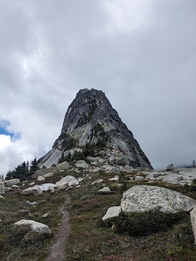
Vicuna
From the saddle we opted to climb Vicuna first, turning south and travelling along the ridge. The scramble is straightforward apart from a single class 4 step, a foot jam move up a wide crack.
The step is exposed and commits you to a couple of moves without great hands or feet, and the rock was still slightly damp from the overnight rain when we got to it. We spent a few minutes working out how we wanted to do it before just pushing straight up the obvious line. Thankfully it is short, and above it we were back on easy class 3 terrain to the summit. I found my big hiking boots imprecise for the crux step, approach shoes would've been nice but given the wet conditions they weren't the right choice for the approach that day.
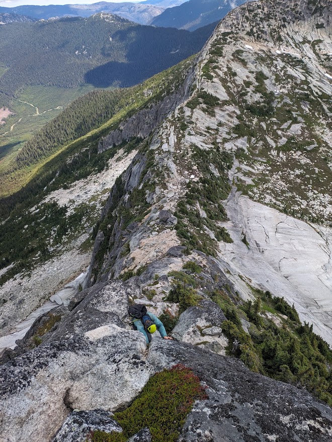
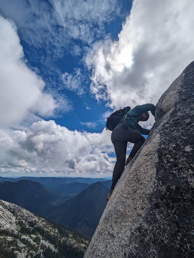
In years previous there has been a handline fixed at this step, but it had been removed by the time we were there. A bolt and hanger is still in the rock immediately above the crux on the right. I did not look closely at it so can't speak to its quality, assess it yourself before trusting it. It may well be worth carrying five to ten metres of cordelette to rig your own handline and make the downclimb easier.
Guanaco
We descended Vicuna by the route we had come up and returned to the saddle, then tacked north toward Guanaco. The best line turned out to be on the west side of the ridge, coming up through alternating slabs and meadowed benches without any major difficulties.
We took a minute at the top to enjoy the view, then came down a slightly different route on the east side of the ridge. Our ascent line was certainly the better of the two. On the descent we had to traverse a couple of times to avoid getting cliffed out.
Return
The return was straightforward, following the same route we used on the way up: back over the saddle, down through the meadows and boulder fields, into the trees on the climbers trail, and out along the road to the truck. Two hours from the summit of Guanaco to the parking spot.
Thoughts, and a link-up
All in all, Vicuna and Guanaco make for a quality day in the alpine. If the access road ever improves and it becomes reasonable to drive closer to the trailhead, I could see this scramble becoming very popular. The rock is of similar quality to the fun granite found on the ridges of Needle and Markhor.
Up on the summit of Vicuna we talked about the possibility of linking these peaks with the ridgeline of Zupjok, Llama and Alpaca. It looks like you can skirt around the cliff band north of Alpaca by continuing another kilometre or two further west along the ridge. The big question mark in making that link-up work is whether it is reasonable to gain Vicuna from the south side. Solving that one will have to wait for another day.